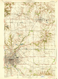
1954 Map of Freeburg
USGS Topo · Published 1958About this map
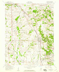
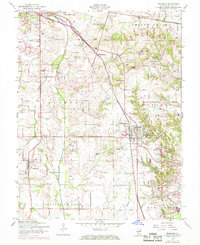
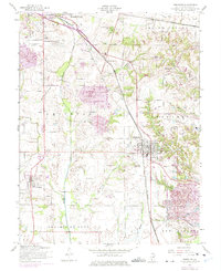
Freeburg and Smithton anchor this mid-century survey of St. Clair County, depicting a landscape where agriculture, transportation, and industry intersect. The Illinois Central and Louisville and Nashville railroads bisect the terrain, facilitating the movement of goods between the local coal resources and the greater metropolitan region. A large Strip Mine in the southern portion of the quadrangle near New Athens reveals the active extraction era, while numerous small schools like Hertel Sch and Lemen Sch suggest a rural community structure still very much intact.
Find a feature on this map
45 named features on this map. Tap any name to fly to it.
Don’t see what you’re looking for? This feature index may not catch every label — zoom into the map to look around manually.
Map Details
Editions of this 1954 Freeburg Map
3 editions found
Other maps of this area

1888 · St. Louis
USGS Topo · 1:62,500

1907 · Belleville
USGS Topo · 1:62,500

1910 · Waterloo
USGS Topo · 1:62,500

1912 · New Athens
USGS Topo · 1:62,500

1913 · Waterloo
USGS Topo · 1:62,500

1931 · French Village
USGS Topo · 1:24,000
1935 · Lebanon
USGS Topo · 1:24,000
1935 · French Village
USGS Topo · 1:24,000
1937 · O'Fallon
USGS Topo · 1:24,000

1949 · Saint Louis
USGS Topo · 1:250,000