
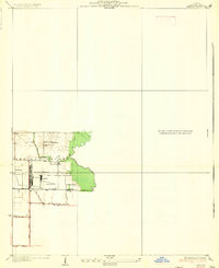
1935 Map of Lebanon
USGS Topo · Published 1935About this map
Scott Field stands as the dominant feature of this mid-1930s landscape in Shiloh Valley. This specific survey highlights early aviation infrastructure, explicitly labeling a Hangar and a Mooring Mast, reflecting the airfield's significance during the era of dirigibles and early military flight. The surrounding area remains largely agricultural, punctuated by small rural hubs like Grassland, which is served by the Southern railroad line. Local education and community life are anchored at Cherry Grove Sch and Grassland Sch, while Silver Creek meanders along the eastern edge of the surveyed area. This map provides a rare, high-detail look at the airfield's layout and its relationship to the existing regional road network, including State Hy No 161 and U.S. Hy No. 50, just before significant mid-century expansions changed the local topography.
Find a feature on this map
13 named features on this map. Tap any name to fly to it.
Don’t see what you’re looking for? This feature index may not catch every label — zoom into the map to look around manually.
Map Details
Editions of this 1935 Lebanon Map
2 editions found
Other maps of this area

1906 · Breese
USGS Topo · 1:62,500

1907 · Breese
USGS Topo · 1:62,500

1907 · Belleville
USGS Topo · 1:62,500

1910 · Okawville
USGS Topo · 1:62,500

1912 · New Athens
USGS Topo · 1:62,500

1937 · Collinsville
USGS Topo · 1:24,000

1937 · O'Fallon
USGS Topo · 1:24,000

1940 · Okawville
USGS Topo · 1:62,500

1949 · Lebanon
USGS Topo · 1:24,000

1949 · St. Jacob
USGS Topo · 1:24,000