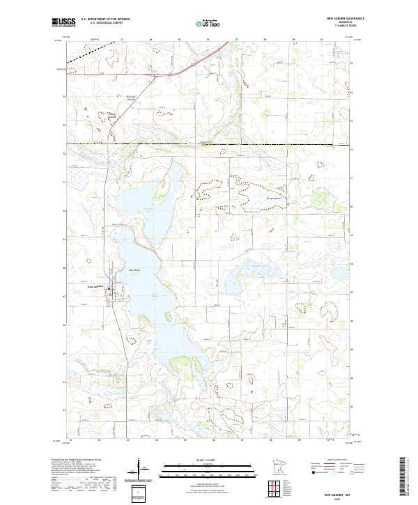
2022 Map of New Auburn
USGS Topo · Published 2022About this map
The settlement of New Auburn serves as the focal point of this Sibley County landscape, situated just north of the extensive High Island Lake. This region of Minnesota is defined by its complex hydrography, where traditional lakes sit alongside drained depressions like Berge Lakebed, Brewster Lakebed, and Thoneys Lakebed. The topography is subtly marked by the distinct rise of High Island and the meandering paths of High Island Cr and Buffalo Cr. The map reveals a highly structured agricultural grid, with the Sibley and McLeod county line bisecting the northern section. Water management is a critical feature of the terrain, documented through engineered drainage systems such as Judicial Ditch Number Nineteen and County Ditch Number Twelve A. Small water bodies like Hahn Lake, Grack Lake, and Kirby Lake pepper the township, illustrating the persistent prairie pothole nature of the area even as land has been reclaimed for farming.
Find a feature on this map
84 named features on this map. Tap any name to fly to it.
Don’t see what you’re looking for? This feature index may not catch every label — zoom into the map to look around manually.
Map Details
Editions of this 2022 New Auburn Map
This is the sole edition of this map. No revisions or reprints were ever made.
Other maps of this area

1953 · New Ulm
USGS Topo · 1:250,000

1957 · New Ulm
USGS Topo · 1:250,000

1958 · New Ulm
USGS Topo · 1:250,000

1958 · Gaylord
USGS Topo · 1:62,500

1958 · Glencoe
USGS Topo · 1:62,500

1958 · Winthrop
USGS Topo · 1:62,500

1958 · Hutchinson
USGS Topo · 1:62,500

1967 · New Ulm
USGS Topo · 1:250,000
1982 · Plato
USGS Topo · 1:24,000
1982 · Biscay
USGS Topo · 1:24,000
Featured Places
- New Auburn, MN
- Glencoe Township, MN
- Helen Township, MN
- Ringo Mobile Home Park, New Auburn
- McLeod County, MN