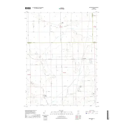
2018 Map of New Bedford
USGS Topo · Published 2018About this map
The Green River meandering through the Illinois prairie defines the agrarian character of this 2018 landscape, situated where Bureau, Whiteside, and Lee counties meet. The small village of New Bedford sits in the southwestern portion, anchored by the intersection of S Main St and Co Rd 9. This modern survey illustrates the intensive engineering of the local hydrology, with numerous man-made channels such as the Main Ditch, Normandy Ditch, and Walnut Special Ditch designed to manage the watershed for agriculture. To the north and east, the communities of Deer Grove and Normandy serve as local hubs for the surrounding farmsteads. Genealogical interest is found at Fairfield Cem and Bowen Cem, while local aviation is marked by the private Woodley 2 Airport and Geldean Airport, reflecting the rural utility and low-density settlement of the region.
Find a feature on this map
71 named features on this map. Tap any name to fly to it.
Don’t see what you’re looking for? This feature index may not catch every label — zoom into the map to look around manually.
Map Details
Editions of this 2018 New Bedford Map
This is the sole edition of this map. No revisions or reprints were ever made.
Other maps of this area

1921 · Buda
USGS Topo · 1:62,500

1923 · Buda
USGS Topo · 1:62,500

1929 · Annawan
USGS Topo · 1:62,500

1932 · Prophetstown
USGS Topo · 1:48,000

1932 · Annawan
USGS Topo · 1:62,500

1936 · Prophetstown
USGS Topo · 1:62,500

1949 · Walnut
USGS Topo · 1:62,500

1958 · Aurora
USGS Topo · 1:250,000

1961 · Aurora
USGS Topo · 1:250,000

1982 · Harmon
USGS Topo · 1:24,000