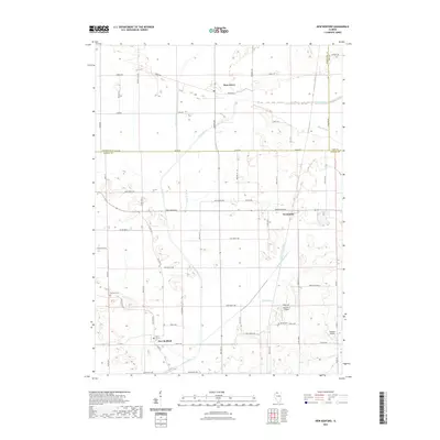
2021 Map of New Bedford
USGS Topo · Published 2021About this map
New Bedford and Deer Grove anchor this agricultural landscape at the tri-county junction of Bureau, Lee, and Whiteside Counties. The terrain is defined by an extensive network of water management, where the Green River is supported by a series of engineered waterways including Main Ditch, Baker Cr Ditch, and the Walnut Special Ditch. This infrastructure highlights the region's long-standing commitment to draining the fertile lowlands for cultivation. Local history is preserved at sites like Fairfield Cem and Bowen Cem, while the small settlement of Normandy serves as a secondary crossroads. The presence of private airfields like Woodley 2 Airport and Geldean Airport reflects the modern utility of this wide-open prairie land, which remains largely structured by a rigid grid of rural roads such as Osage Rd and Hurd Rd.
Find a feature on this map
71 named features on this map. Tap any name to fly to it.
Don’t see what you’re looking for? This feature index may not catch every label — zoom into the map to look around manually.
Map Details
Editions of this 2021 New Bedford Map
This is the sole edition of this map. No revisions or reprints were ever made.
Other maps of this area

1921 · Buda
USGS Topo · 1:62,500

1923 · Buda
USGS Topo · 1:62,500

1929 · Annawan
USGS Topo · 1:62,500

1932 · Prophetstown
USGS Topo · 1:48,000

1932 · Annawan
USGS Topo · 1:62,500

1936 · Prophetstown
USGS Topo · 1:62,500

1949 · Walnut
USGS Topo · 1:62,500

1958 · Aurora
USGS Topo · 1:250,000

1961 · Aurora
USGS Topo · 1:250,000

1982 · Harmon
USGS Topo · 1:24,000