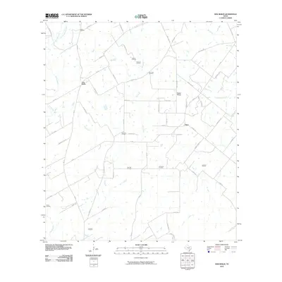
2010 Map of New Berlin
USGS Topo · Published 2010About this map
Cibolo Creek and its many tributaries, including Blue Creek and Elm Creek, define the rural geography of this Guadalupe County landscape. Small communities and named crossroads such as New Berlin, Sweet Home, and Olmos are connected by a network of farm roads and family-named lanes like Kunde Rd and Brietzke Rd. The area is characterized by its high density of family and community burial grounds, with eight distinct sites mapped including Linne Cemetery, Schmidt Cemetery, and the Concrete Cemetery in the south. The southeastern portion of the sheet reveals the industrial presence of the La Vernia Oil Field, where numerous well pads dot the terrain alongside winding paths like O'Daniel Rd. This collection of features reflects a persistent agrarian pattern interspersed with modern petroleum extraction and deep-rooted local history.
Find a feature on this map
62 named features on this map. Tap any name to fly to it.
Don’t see what you’re looking for? This feature index may not catch every label — zoom into the map to look around manually.
Map Details
Editions of this 2010 New Berlin Map
This is the sole edition of this map. No revisions or reprints were ever made.
Other maps of this area

1911 · San Marcos
USGS Topo · 1:125,000

1919 · San Marcos
USGS Topo · 1:125,000

1920 · Smiley
USGS Topo · 1:125,000

1924 · New Braunfels No 4
USGS Topo · 1:48,000

1924 · San Marcos 3-c
USGS Topo · 1:48,000

1927 · New Braunfels
USGS Topo · 1:62,500

1930 · Seguin
USGS Topo · 1:62,500

1942 · Dewville
USGS Topo · 1:62,500

1953 · Seguin
USGS Topo · 1:250,000

1954 · San Antonio
USGS Topo · 1:250,000