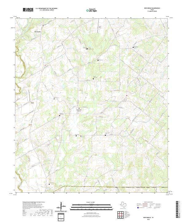
2022 Map of New Berlin
USGS Topo · Published 2022About this map
New Berlin anchors this central Texas landscape, where the headwaters of Elm Cr and Santa Clara Cr carve through a terrain defined by legacy family holdings and community gathering places. The map is particularly dense with genealogical markers, noting numerous burial grounds such as the Christ Lutheran Church of Elm Creek Cem and the Doege Family Cem. This pattern of family-named cemeteries like Warncke Cem and Schmidt Cem suggests a history of generational land stewardship that persisted well into the 21st century.
Find a feature on this map
81 named features on this map. Tap any name to fly to it.
Don’t see what you’re looking for? This feature index may not catch every label — zoom into the map to look around manually.
Map Details
Editions of this 2022 New Berlin Map
This is the sole edition of this map. No revisions or reprints were ever made.
Other maps of this area

1911 · San Marcos
USGS Topo · 1:125,000

1919 · San Marcos
USGS Topo · 1:125,000

1920 · Smiley
USGS Topo · 1:125,000

1924 · New Braunfels No 4
USGS Topo · 1:48,000

1924 · San Marcos 3-c
USGS Topo · 1:48,000

1927 · New Braunfels
USGS Topo · 1:62,500

1930 · Seguin
USGS Topo · 1:62,500

1942 · Dewville
USGS Topo · 1:62,500

1953 · Seguin
USGS Topo · 1:250,000

1954 · San Antonio
USGS Topo · 1:250,000