
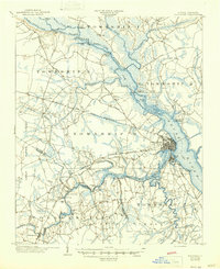
1903 Map of New Bern
USGS Topo · Published 1935About this map
New Bern sits at the confluence of the Neuse River and the Trent River, serving as a vital transportation hub in the early 20th century. This survey reveals a landscape deeply connected by water and rail, where a designated Steamboat Route navigates the rivers and the Atlantic and North Carolina R. R. bisects the terrain. The presence of specialized sites like the Quarantine Station downstream and the Old Fort near the city center provides insight into the maritime and historical priorities of the era.
Find a feature on this map
68 named features on this map. Tap any name to fly to it.
Don’t see what you’re looking for? This feature index may not catch every label — zoom into the map to look around manually.
Map Details
Editions of this 1903 New Bern Map
2 editions found
Other maps of this area

1901 · New Bern
USGS Topo · 1:62,500

1902 · Ayden
USGS Topo · 1:62,500

1902 · Vanceboro
USGS Topo · 1:62,500

1903 · Trent River
USGS Topo · 1:62,500

1904 · Ayden
USGS Topo · 1:62,500

1904 · Trent River
USGS Topo · 1:62,500

1904 · Vanceboro
USGS Topo · 1:62,500

1905 · Vanceboro
USGS Topo · 1:62,500

1942 · Maysville
USGS Topo · 1:62,500

1943 · Jacksonville
USGS Topo · 1:62,500