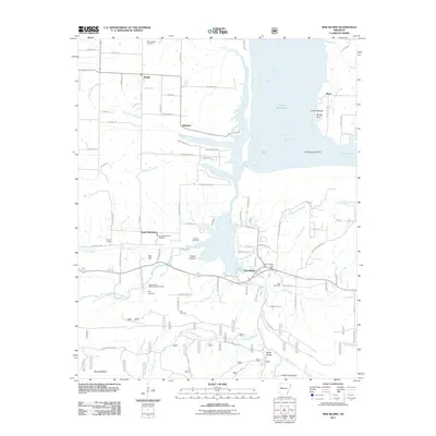
2011 Map of New Blaine
USGS Topo · Published 2011About this map
Lake Dardanelle dominates the northern landscape of this region, where the Arkansas River widens around Shoal Creek Island and Collins Shoals. The settlement of New Blaine serves as a local hub south of the water, anchored by the New Blaine Post Office and nearby Hall Cemetery. The area’s historical geography is defined by a series of creeks, including Big Shoal Creek and Mill Creek, which drain the varied terrain of Cedar Bottom and Tater Hill.
Find a feature on this map
95 named features on this map. Tap any name to fly to it.
Don’t see what you’re looking for? This feature index may not catch every label — zoom into the map to look around manually.
Map Details
Editions of this 2011 New Blaine Map
This is the sole edition of this map. No revisions or reprints were ever made.
Other maps of this area

1879 · Mountain Home
USGS Topo · 1:62,500

1887 · Magazine Mountain #1
USGS Topo · 1:62,500

1887 · Magazine Mountain #4
USGS Topo · 1:62,500

1887 · Magazine Mountain
USGS Topo · 1:62,500

1888 · Dardanelle #2
USGS Topo · 1:62,500

1888 · Dardanelle #3
USGS Topo · 1:62,500

1890 · Magazine Mountain
USGS Topo · 1:125,000

1890 · Dardanelle
USGS Topo · 1:125,000

1956 · Russellville
USGS Topo · 1:250,000
1961 · Hartman
USGS Topo · 1:24,000