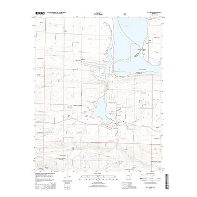
2014 Map of New Blaine
USGS Topo · Published 2014About this map
Lake Dardanelle and the Arkansas River dominate the northern and eastern reaches of this landscape, marking the border between Logan and Johnson counties. The terrain transitions from the low-lying Cedar Bottom and islands like Shoal Creek Island to the higher elevations of the Ozark National Forest in the south. The area is dotted with small rural communities, including New Blaine and Saint-Scholastica, where family legacies are preserved in numerous local burying grounds such as Saint-Scholastica Cem and Tritt Cem.
Find a feature on this map
93 named features on this map. Tap any name to fly to it.
Don’t see what you’re looking for? This feature index may not catch every label — zoom into the map to look around manually.
Map Details
Editions of this 2014 New Blaine Map
This is the sole edition of this map. No revisions or reprints were ever made.
Other maps of this area

1879 · Mountain Home
USGS Topo · 1:62,500

1887 · Magazine Mountain #1
USGS Topo · 1:62,500

1887 · Magazine Mountain #4
USGS Topo · 1:62,500

1887 · Magazine Mountain
USGS Topo · 1:62,500

1888 · Dardanelle #2
USGS Topo · 1:62,500

1888 · Dardanelle #3
USGS Topo · 1:62,500

1890 · Magazine Mountain
USGS Topo · 1:125,000

1890 · Dardanelle
USGS Topo · 1:125,000

1956 · Russellville
USGS Topo · 1:250,000
1961 · Hartman
USGS Topo · 1:24,000