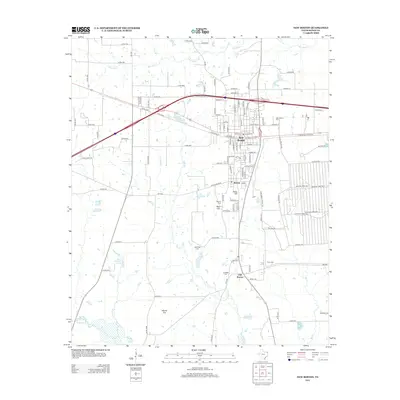
2012 Map of New Boston
USGS Topo · Published 2012About this map
New Boston serves as the central hub of this Bowie County landscape, illustrating a classic shift in Texas settlement patterns from the original town site of Old Boston toward the railroad-aligned northern district. The map captures a high density of genealogical landmarks, including New Boston Cem, Rea Hill Cem, and McWright Cem, which are scattered among the rolling hills of the region. Distinctive terrain features like Glass Hill and Adams Hill overlook a network of creek systems, most notably Rice Cr, Big Cr, and Red Bayou. A unique historical point of interest is the Boston Chalybeate Springs, suggesting the area's legacy of mineral water attractions. The infrastructure is defined by a dense web of county roads and farm-to-market routes, such as FM-1840 and FM-992, which connect these established communities and rural homesteads.
Find a feature on this map
123 named features on this map. Tap any name to fly to it.
Don’t see what you’re looking for? This feature index may not catch every label — zoom into the map to look around manually.
Map Details
Editions of this 2012 New Boston Map
This is the sole edition of this map. No revisions or reprints were ever made.
Other maps of this area

1909 · New Boston
USGS Topo · 1:62,500

1930 · Bassett
USGS Topo · 1:62,500

1950 · Redbank
USGS Topo · 1:24,000

1950 · De Kalb
USGS Topo · 1:24,000

1951 · De Kalb
USGS Topo · 1:24,000

1951 · Redbank
USGS Topo · 1:24,000

1951 · Daniels Chapel
USGS Topo · 1:24,000

1953 · Texarkana
USGS Topo · 1:250,000

1954 · New Boston
USGS Topo · 1:24,000

1954 · Hooks
USGS Topo · 1:24,000