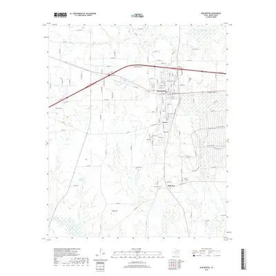
2019 Map of New Boston
USGS Topo · Published 2019About this map
Old Boston, Boston, and the modern hub of New Boston create a distinct historical progression across the Bowie County landscape. This 2019 survey captures the transition from original settlements toward more modern infrastructure, while still documenting the enduring legacy of the area's early residents through numerous burial grounds like McWright Cem and Hays Cem. The northern boundary is defined by the winding course of Red Bayou, while the central terrain is marked by prominent elevations such as Glass Hill and Adams Hill. Local landmarks like the Boston Chalybeate Springs and Old Tand P Lake point to the area's natural resource history. The map also meticulously labels modern neighborhood streets such as Huntington Dr and Deerfield Ln, contrasting with the surrounding rural county roads and agricultural lands.
Find a feature on this map
123 named features on this map. Tap any name to fly to it.
Don’t see what you’re looking for? This feature index may not catch every label — zoom into the map to look around manually.
Map Details
Editions of this 2019 New Boston Map
This is the sole edition of this map. No revisions or reprints were ever made.
Other maps of this area

1909 · New Boston
USGS Topo · 1:62,500

1930 · Bassett
USGS Topo · 1:62,500

1950 · Redbank
USGS Topo · 1:24,000

1950 · De Kalb
USGS Topo · 1:24,000

1951 · De Kalb
USGS Topo · 1:24,000

1951 · Redbank
USGS Topo · 1:24,000

1951 · Daniels Chapel
USGS Topo · 1:24,000

1953 · Texarkana
USGS Topo · 1:250,000

1954 · New Boston
USGS Topo · 1:24,000

1954 · Hooks
USGS Topo · 1:24,000