
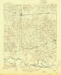
1909 Map of New Boston
USGS Topo · Published 1909About this map
New Boston and the older settlement of Boston anchor this Northeast Texas landscape during a period of significant railway development. The northern portion of the quadrangle is defined by the Texas and Pacific (Sherman Line), which passes through Whaleys and Hooks, while the St Louis Southwestern corridor to the south connects Carbondale, Corley, and Maud. This rail-driven economy is contrasted by the rural network of schools and churches that served the agricultural community, including Chalybeate School, Antioch School, and Shiloh Church. To the south, the meandering Sulphur River serves as the boundary between Bowie and Cass counties. The river's edge is dotted with historic crossing points like Bigham Ferry, Blenn Ferry, and Bettis Bridge, revealing the vital importance of river access before the modern highway system restructured local travel.
Find a feature on this map
61 named features on this map. Tap any name to fly to it.
Don’t see what you’re looking for? This feature index may not catch every label — zoom into the map to look around manually.
Map Details
Editions of this 1909 New Boston Map
2 editions found
Other maps of this area

1907 · Atlanta
USGS Topo · 1:62,500

1909 · Texarkana
USGS Topo · 1:62,500

1910 · Linden
USGS Topo · 1:62,500

1910 · Atlanta
USGS Topo · 1:62,500

1914 · Daingerfield
USGS Topo · 1:62,500

1930 · Bassett
USGS Topo · 1:62,500

1950 · Redbank
USGS Topo · 1:24,000

1950 · Barkman
USGS Topo · 1:24,000

1950 · De Kalb
USGS Topo · 1:24,000

1951 · De Kalb
USGS Topo · 1:24,000