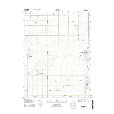
2013 Map of New Bremen
USGS Topo · Published 2013About this map
New Bremen and Minster anchor this 2013 survey of the western Ohio countryside, a landscape defined by its grid-aligned farms and a deep-seated Catholic heritage. The map documents numerous religious landmarks that speak to the region's genealogy, including Saint Johns Catholic Cem and Saint Augustines Cem. Small rural clusters like Maria Stein, Chickasaw, and Egypt are connected by a network of state routes and township roads, while the New Bremen Speedway stands as a distinct recreational landmark north of the main village. This modern topographic study by the U.S. Geological Survey captures the enduring agricultural character of the region, tracing the paths of Chickasaw Creek and Kopp Creek as they meander through the precisely sectioned fields of Auglaize and Mercer counties.
Find a feature on this map
137 named features on this map. Tap any name to fly to it.
Don’t see what you’re looking for? This feature index may not catch every label — zoom into the map to look around manually.
Map Details
Editions of this 2013 New Bremen Map
This is the sole edition of this map. No revisions or reprints were ever made.
Other maps of this area

1908 · St. Henry
USGS Topo · 1:62,500

1909 · Loramie
USGS Topo · 1:62,500

1911 · Loramie
USGS Topo · 1:62,500

1911 · Spencerville
USGS Topo · 1:62,500

1914 · Celina
USGS Topo · 1:62,500

1944 · Loramie
USGS Topo · 1:62,500

1944 · Celina
USGS Topo · 1:62,500

1944 · Spencerville
USGS Topo · 1:62,500

1953 · Muncie
USGS Topo · 1:250,000

1956 · Muncie
USGS Topo · 1:250,000