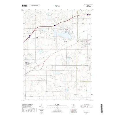
2019 Map of New Carlisle
USGS Topo · Published 2019About this map
Glacial lakes and small rail-side settlements define this landscape along the border of LaPorte and St. Joseph Counties. Hudson Lake and Saugany Lake serve as primary geographical anchors, surrounded by a network of historic rural communities such as Birchim, Lake Park, and Hillside. The map reveals a high concentration of local heritage sites, including the Saint John Kanty Catholic Cem and the New Carlisle Cem, which point to the established genealogy of the region.
Find a feature on this map
108 named features on this map. Tap any name to fly to it.
Don’t see what you’re looking for? This feature index may not catch every label — zoom into the map to look around manually.
Map Details
Editions of this 2019 New Carlisle Map
This is the sole edition of this map. No revisions or reprints were ever made.
Other maps of this area

1927 · Niles
USGS Topo · 1:62,500

1930 · Three Oaks
USGS Topo · 1:62,500

1930 · Niles
USGS Topo · 1:62,500

1943 · Niles
USGS Topo · 1:62,500

1944 · Three Oaks
USGS Topo · 1:62,500

1953 · Chicago
USGS Topo · 1:250,000

1957 · Chicago
USGS Topo · 1:250,000

1958 · Lydick
USGS Topo · 1:24,000

1958 · Stillwell
USGS Topo · 1:24,000

1958 · North Liberty
USGS Topo · 1:24,000