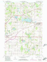
1958 Map of New Carlisle
USGS Topo · Published 1981About this map
New Carlisle serves as a primary hub on this North Central Indiana survey, situated at the intersection of significant transportation routes including the Conrail line and the Chicago South Shore and South Bend railroad. The landscape is defined by its numerous glacial lakes, such as Saugany Lake, Silver Lake, and the expansive Hudson Lake, which supports the small settlements of Hicks and Lake Park. Local history is deeply etched into the rural landscape through family and community landmarks like the Olive Chapel Cem and Teeter Cem.
Find a feature on this map
51 named features on this map. Tap any name to fly to it.
Don’t see what you’re looking for? This feature index may not catch every label — zoom into the map to look around manually.
Map Details
Editions of this 1958 New Carlisle Map
2 editions found

Other maps of this area

1927 · Niles
USGS Topo · 1:62,500

1930 · Three Oaks
USGS Topo · 1:62,500

1930 · Niles
USGS Topo · 1:62,500

1943 · Niles
USGS Topo · 1:62,500

1944 · Three Oaks
USGS Topo · 1:62,500

1953 · Chicago
USGS Topo · 1:250,000

1957 · Chicago
USGS Topo · 1:250,000

1958 · Lydick
USGS Topo · 1:24,000

1958 · Stillwell
USGS Topo · 1:24,000

1958 · North Liberty
USGS Topo · 1:24,000