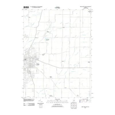
2010 Map of New Castle East
USGS Topo · Published 2010About this map
New Castle serves as the focal point of this eastern Henry County landscape, where the urban grid of the city transitions into a dense network of rural roads and watercourses. The drainage of the region is defined by the Big Blue River and the Flatrock River, supported by numerous named branches such as Lick Branch and Pebble Run. This 2010 survey highlights the infrastructure of the early 21st century, including the New Castle-Henry County Municipal Airport and the smaller New Castle Municipal Airport to the north. Smaller communities like Mooreland, Millville, and Hillsboro remain distinct hubs amidst the agricultural landscape. For those tracing family histories, the map records the locations of Livezey Cemetery in the north and White Heart Cemetery in the southeast. Historical waypoints such as Pierson Station and Van Nuys suggest the enduring importance of local landmarks and transit points in this part of Indiana.
Find a feature on this map
86 named features on this map. Tap any name to fly to it.
Don’t see what you’re looking for? This feature index may not catch every label — zoom into the map to look around manually.
Map Details
Editions of this 2010 New Castle East Map
This is the sole edition of this map. No revisions or reprints were ever made.
Other maps of this area

1948 · Lewisville
USGS Topo · 1:24,000

1949 · New Castle West
USGS Topo · 1:24,000

1950 · New Castle East
USGS Topo · 1:24,000

1950 · Dunreith
USGS Topo · 1:24,000

1950 · Lewisville
USGS Topo · 1:24,000

1953 · Cincinnati
USGS Topo · 1:250,000

1953 · Muncie
USGS Topo · 1:250,000

1956 · Muncie
USGS Topo · 1:250,000

1957 · Cincinnati
USGS Topo · 1:250,000

1960 · New Castle West
USGS Topo · 1:24,000