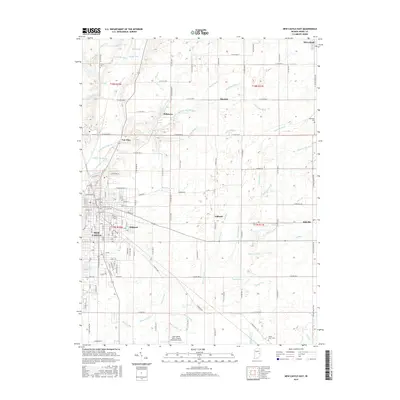
2016 Map of New Castle East
USGS Topo · Published 2016About this map
New Castle serves as the focal point for this survey of eastern Henry County, where the street grid of the city meets an expansive network of rural drains and tributaries. The landscape is defined by its agricultural and drainage history, with numerous named waterways such as Flatrock River, Little Blue River, and the Millville Drain cutting across the section lines. Small communities and named clusters like Mooreland, Millville, and Messick are connected by a rigid system of county roads, reflecting the traditional township and range survey system typical of the Midwest. Genealogists will find several burial sites including Livezey Cem and White Heart Cem, while aviation history is represented by the New Castle-Henry County Municipal Airport to the south. The transition from the urban streets of Belmont and New Castle to the outlying settlements of Van Nuys and Ashland illustrates the region's enduring settlement patterns.
Find a feature on this map
145 named features on this map. Tap any name to fly to it.
Don’t see what you’re looking for? This feature index may not catch every label — zoom into the map to look around manually.
Map Details
Editions of this 2016 New Castle East Map
This is the sole edition of this map. No revisions or reprints were ever made.
Other maps of this area

1948 · Lewisville
USGS Topo · 1:24,000

1949 · New Castle West
USGS Topo · 1:24,000

1950 · New Castle East
USGS Topo · 1:24,000

1950 · Dunreith
USGS Topo · 1:24,000

1950 · Lewisville
USGS Topo · 1:24,000

1953 · Cincinnati
USGS Topo · 1:250,000

1953 · Muncie
USGS Topo · 1:250,000

1956 · Muncie
USGS Topo · 1:250,000

1957 · Cincinnati
USGS Topo · 1:250,000

1960 · New Castle West
USGS Topo · 1:24,000