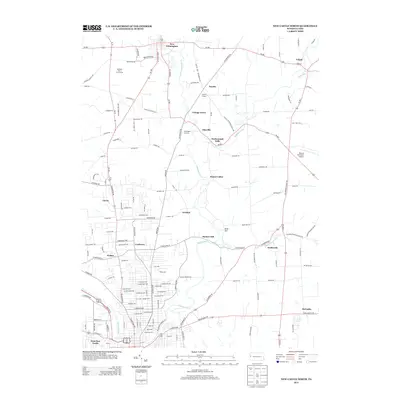
2013 Map of New Castle North
USGS Topo · Published 2013About this map
Neshannock Cr and its tributaries, including Little Neshannock Cr and Hottenbaugh Run, carve through the landscape of Lawrence County north of the city. The settlement pattern here is a mix of established boroughs like New Wilmington and Volant alongside smaller rural crossroads and neighborhoods such as Coaltown, Fayette, and Sunset Valley. The northern outskirts of West New Castle appear in the lower corner, showing a dense street grid that transitions rapidly into the agricultural and wooded surroundings of Painter Hill and Briar Hill. This area is marked by localized landmarks such as the Fayette Chapel and Borlands Par 3 Golf Course, while aviation interests are represented by the Barnes Farmland Airport. The road network, including Pa-18 and Pa-208, connects these scattered communities across a terrain defined by narrow creek valleys and broad upland plateaus.
Find a feature on this map
160 named features on this map. Tap any name to fly to it.
Don’t see what you’re looking for? This feature index may not catch every label — zoom into the map to look around manually.
Map Details
Editions of this 2013 New Castle North Map
This is the sole edition of this map. No revisions or reprints were ever made.
Other maps of this area

1902 · New Castle
USGS Topo · 1:62,500

1904 · Newcastle
USGS Topo · 1:62,500

1905 · Neshannock
USGS Topo · 1:62,500

1907 · Neshannock
USGS Topo · 1:62,500

1908 · Zelienople
USGS Topo · 1:62,500

1910 · Zelienople
USGS Topo · 1:62,500

1913 · Mercer
USGS Topo · 1:62,500

1939 · Mercer
USGS Topo · 1:62,500

1943 · Mercer
USGS Topo · 1:62,500

1950 · Cleveland
USGS Topo · 1:250,000