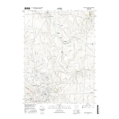
2016 Map of New Castle North
USGS Topo · Published 2016About this map
Westminster Coll stands prominently in New Wilmington as the landscape transitions from the dense urban development of New Castle toward the rural northern reaches of the Lawrence Co and Mercer Co border. This region is defined by the winding course of Neshannock Creek and its tributaries, which have shaped the settlement patterns from the historical center of Eastbrook to the small village of Volant in the northeast corner. The northern expansion of the city is evident in the residential clusters of Walmo, Coaltown, and Oakwood, while numerous burial grounds like Saint Josephs Cem and Castle View Cem provide critical touchpoints for genealogical research. Local transit and agricultural history are reflected in specialized landmarks such as Bartsch Airport and Barnes Farmland Airport, highlighting the area's mix of academic, suburban, and rural identities.
Find a feature on this map
170 named features on this map. Tap any name to fly to it.
Don’t see what you’re looking for? This feature index may not catch every label — zoom into the map to look around manually.
Map Details
Editions of this 2016 New Castle North Map
This is the sole edition of this map. No revisions or reprints were ever made.
Other maps of this area

1902 · New Castle
USGS Topo · 1:62,500

1904 · Newcastle
USGS Topo · 1:62,500

1905 · Neshannock
USGS Topo · 1:62,500

1907 · Neshannock
USGS Topo · 1:62,500

1908 · Zelienople
USGS Topo · 1:62,500

1910 · Zelienople
USGS Topo · 1:62,500

1913 · Mercer
USGS Topo · 1:62,500

1939 · Mercer
USGS Topo · 1:62,500

1943 · Mercer
USGS Topo · 1:62,500

1950 · Cleveland
USGS Topo · 1:250,000