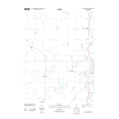
2013 Map of New Castle West
USGS Topo · Published 2013About this map
Big Blue River and its numerous tributaries, including Duck Cr and Mound Run, define the drainage patterns of this Henry County landscape. The area is characterized by a dense network of county roads that connect established settlements such as Cadiz, Westwood, and Greensboro. Small rural hubs like Mount Lawn and the railway-associated Fayne Siding illustrate the historical settlement patterns of eastern Indiana. Local aviation is represented by Roberts Field Airport and Ferrell Airport, while the presence of Elliott Cemetery serves as a vital point of interest for genealogists tracing local families. The map also documents specific water features like Giboney Lake and various agricultural drainage projects, such as Veatch Ditch and Post Ditch, which underscore the region's managed landscape.
Find a feature on this map
140 named features on this map. Tap any name to fly to it.
Don’t see what you’re looking for? This feature index may not catch every label — zoom into the map to look around manually.
Map Details
Editions of this 2013 New Castle West Map
This is the sole edition of this map. No revisions or reprints were ever made.
Other maps of this area

1948 · Lewisville
USGS Topo · 1:24,000

1949 · New Castle West
USGS Topo · 1:24,000

1950 · New Castle East
USGS Topo · 1:24,000

1950 · Dunreith
USGS Topo · 1:24,000

1950 · Lewisville
USGS Topo · 1:24,000

1953 · Cincinnati
USGS Topo · 1:250,000

1953 · Muncie
USGS Topo · 1:250,000

1956 · Muncie
USGS Topo · 1:250,000

1957 · Cincinnati
USGS Topo · 1:250,000

1960 · New Castle West
USGS Topo · 1:24,000