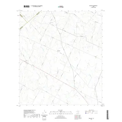
2019 Map of New Davy
USGS Topo · Published 2019About this map
Gruenau and New Davy anchor this agricultural landscape at the tri-county corner where DeWitt, Gonzales, and Karnes counties meet. The terrain is defined by a dense network of creek drainages, including the prominent Fifteenmile Coleto Cr and Little Salt Cr, which carve through the countryside. These waterways influenced the placement of early road networks such as Grueneau Rd and Gus Meyer Rd, many of which follow the natural ridgelines between watersheds. For those researching local family history, the map identifies small burial sites like House Cem and Sand Gate Cem, providing precise locations for these often overlooked rural landmarks. The survey also captures a long-standing ranching presence through labels like Dubose Ranch Rd, illustrating the enduring land-use patterns of the South Texas plains.
Find a feature on this map
53 named features on this map. Tap any name to fly to it.
Don’t see what you’re looking for? This feature index may not catch every label — zoom into the map to look around manually.
Map Details
Editions of this 2019 New Davy Map
This is the sole edition of this map. No revisions or reprints were ever made.
Other maps of this area

1920 · Smiley
USGS Topo · 1:125,000

1953 · Beeville
USGS Topo · 1:250,000

1953 · Seguin
USGS Topo · 1:250,000

1956 · Beeville
USGS Topo · 1:250,000

1958 · Seguin
USGS Topo · 1:250,000

1960 · Beeville
USGS Topo · 1:250,000

1960 · Blackwell Lake
USGS Topo · 1:24,000

1960 · Westhoff
USGS Topo · 1:24,000

1961 · Sample
USGS Topo · 1:24,000

1961 · New Davy
USGS Topo · 1:24,000