
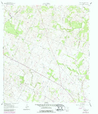
1961 Map of New Davy
USGS Topo · Published 1963About this map
New Davy and Gruenau anchor this rural landscape in the early 1960s, situated at the converging corners of DeWitt, Gonzales, and Karnes Counties. The terrain is defined by a dense network of seasonal drainage, most notably the winding paths of Little Salt Creek, Clear Creek, and Fifteenmile Creek. These waterways carve through the undulating Texas countryside, creating a complex topography of draws and ridges. For genealogists and local historians, the inclusion of Sand Gate Cem and National Cem provides precise locations for significant community landmarks. The map also records the economic utility of the land, noting several Gravel Pits interspersed among the creek beds. Fine red dashed lines denote property fence lines, revealing the intricate parceling of the area during this era of Texas ranching and agriculture.
Find a feature on this map
14 named features on this map. Tap any name to fly to it.
Don’t see what you’re looking for? This feature index may not catch every label — zoom into the map to look around manually.
Map Details
Editions of this 1961 New Davy Map
2 editions found
Other maps of this area

1920 · Smiley
USGS Topo · 1:125,000

1953 · Beeville
USGS Topo · 1:250,000

1953 · Seguin
USGS Topo · 1:250,000

1956 · Beeville
USGS Topo · 1:250,000

1958 · Seguin
USGS Topo · 1:250,000

1960 · Beeville
USGS Topo · 1:250,000

1960 · Blackwell Lake
USGS Topo · 1:24,000

1960 · Westhoff
USGS Topo · 1:24,000

1961 · Sample
USGS Topo · 1:24,000
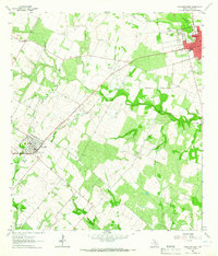
1963 · Yorktown West
USGS Topo · 1:24,000