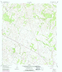
1961 Map of New Davy
USGS Topo · Published 1987About this map
New Davy and Gruenau anchor this rural landscape in DeWitt County during the early 1960s, a region defined by its complex drainage network and agricultural heritage. The terrain is deeply carved by the branching paths of Salt Creek, Little Salt Creek, and Yorktown Creek, creating a varied topography of ridges and draws. For family historians and researchers, the map provides precise locations for the National Cem and Sand Gate Cem, the latter situated near a namesake landmark. While predominantly rural, the presence of several Gravel Pit locations and a dedicated Gravel Pits area indicates the local extraction industry that supported road building across the county. This 1961 survey, later photorevised in 1987, also captures the three-way intersection of the Gonzales Co Karnes Co De Witt Co boundaries in the northwestern corner, illustrating the administrative geometry of the Texas coastal plain.
Find a feature on this map
13 named features on this map. Tap any name to fly to it.
Don’t see what you’re looking for? This feature index may not catch every label — zoom into the map to look around manually.
Map Details
Editions of this 1961 New Davy Map
2 editions found
Other maps of this area

1920 · Smiley
USGS Topo · 1:125,000

1953 · Beeville
USGS Topo · 1:250,000

1953 · Seguin
USGS Topo · 1:250,000

1956 · Beeville
USGS Topo · 1:250,000

1958 · Seguin
USGS Topo · 1:250,000

1960 · Beeville
USGS Topo · 1:250,000

1960 · Blackwell Lake
USGS Topo · 1:24,000

1960 · Westhoff
USGS Topo · 1:24,000

1961 · Sample
USGS Topo · 1:24,000

1961 · New Davy
USGS Topo · 1:24,000