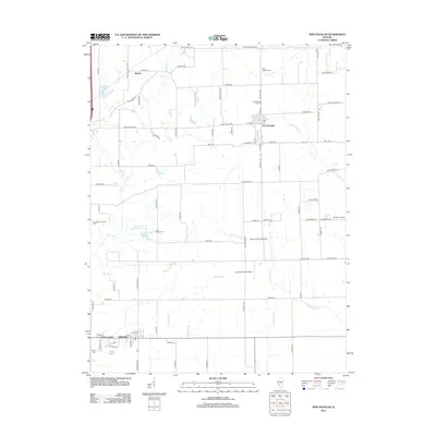
2012 Map of New Douglas
USGS Topo · Published 2012About this map
The agrarian landscape of northeastern Madison County is defined by its small villages and extensive drainage network of silver and sugar forks. New Douglas serves as a focal point in the northern reach, where the New Douglas City Cem and Saint Ubaldus Cem mark the heritage of local families. To the south, Alhambra and the settlement of Green Castle anchor the map, surrounded by evidence of early 21st-century industry and transport, including the Livingston South Oil Field and the Staunton Coal Company Reservoir.
Find a feature on this map
84 named features on this map. Tap any name to fly to it.
Don’t see what you’re looking for? This feature index may not catch every label — zoom into the map to look around manually.
Map Details
Editions of this 2012 New Douglas Map
This is the sole edition of this map. No revisions or reprints were ever made.
Other maps of this area

1912 · Gillespie
USGS Topo · 1:62,500

1915 · Gillespie
USGS Topo · 1:62,500

1915 · Mount Olive
USGS Topo · 1:62,500

1927 · Edwardsville
USGS Topo · 1:62,500

1932 · Edwardsville
USGS Topo · 1:62,500

1937 · New Douglas
USGS Topo · 1:48,000

1944 · New Douglas
USGS Topo · 1:62,500

1944 · Mount Olive
USGS Topo · 1:62,500
1954 · Marine
USGS Topo · 1:24,000

1954 · Worden
USGS Topo · 1:24,000