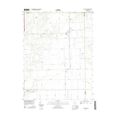
2015 Map of New Douglas
USGS Topo · Published 2015About this map
The agrarian landscape of northeastern Madison County is defined by the headwaters of the Silver Creek system, where several major tributaries converge near the village of New Douglas. This area has long supported local industry, evidenced by the Staunton Coal Company Reservoir and the Big Four Reservoir near the settlement of Binney. The map details a well-established network of rural roads that connect small communities like Alhambra and Green Castle across the prairie. For those researching local history, the map precisely locates several community burial grounds, including Saint Ubaldus Cem, New Douglas City Cem, and Saint Vincent Cem. These features, along with the clearly marked county lines for Macoupin, Montgomery, and Bond counties, highlight the intersection of civil boundaries and early Illinois settlements. The drainage patterns of Little Silver Cr and the Sugar Fork further illustrate the terrain that shaped the development of these farm-to-market hubs.
Find a feature on this map
70 named features on this map. Tap any name to fly to it.
Don’t see what you’re looking for? This feature index may not catch every label — zoom into the map to look around manually.
Map Details
Editions of this 2015 New Douglas Map
This is the sole edition of this map. No revisions or reprints were ever made.
Other maps of this area

1912 · Gillespie
USGS Topo · 1:62,500

1915 · Gillespie
USGS Topo · 1:62,500

1915 · Mount Olive
USGS Topo · 1:62,500

1927 · Edwardsville
USGS Topo · 1:62,500

1932 · Edwardsville
USGS Topo · 1:62,500

1937 · New Douglas
USGS Topo · 1:48,000

1944 · New Douglas
USGS Topo · 1:62,500

1944 · Mount Olive
USGS Topo · 1:62,500
1954 · Marine
USGS Topo · 1:24,000

1954 · Worden
USGS Topo · 1:24,000