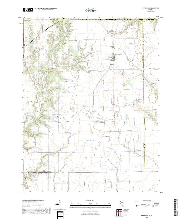
2024 Map of New Douglas
USGS Topo · Published 2024About this map
The agrarian landscape of northeastern Madison County unfolds around the villages of New Douglas and Alhambra in this contemporary topographical view. A significant industrial footprint is evidenced by the Staunton Coal Company Reservoir, providing a clear link to the region's mining history. The settlement pattern is characterized by several family and parish burial grounds, including Saint Vincent Cem, New Douglas City Cem, and Harris Cem, which serve as vital landmarks for genealogists tracing local lineage. The terrain is defined by the drainage of Silver Creek and its many tributaries, such as the East Fork Silver Creek and Sugar Fork. Between the larger settlements, the hamlet of Binney remains a distinct point on the map, while Hammock Field indicates a specialized land use in this largely rural interior. The grid of county roads and named avenues, such as Hillsboro Rd and Mount Olive Rd, connects the disparate farmsteads and reservoirs that dominate the countryside.
Find a feature on this map
76 named features on this map. Tap any name to fly to it.
Don’t see what you’re looking for? This feature index may not catch every label — zoom into the map to look around manually.
Map Details
Editions of this 2024 New Douglas Map
This is the sole edition of this map. No revisions or reprints were ever made.
Other maps of this area

1912 · Gillespie
USGS Topo · 1:62,500

1915 · Gillespie
USGS Topo · 1:62,500

1915 · Mount Olive
USGS Topo · 1:62,500

1927 · Edwardsville
USGS Topo · 1:62,500

1932 · Edwardsville
USGS Topo · 1:62,500

1937 · New Douglas
USGS Topo · 1:48,000

1944 · New Douglas
USGS Topo · 1:62,500

1944 · Mount Olive
USGS Topo · 1:62,500
1954 · Marine
USGS Topo · 1:24,000

1954 · Worden
USGS Topo · 1:24,000