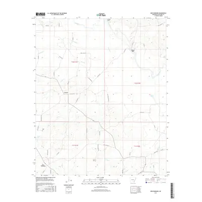
2017 Map of New Edinburg
USGS Topo · Published 2017About this map
New Edinburg anchors the southwestern corner of this landscape, where the road network transitions from rural routes like Banks Rd and Tollfrie Rd into the creek-carved lowlands. The Saline River winds through the northern and eastern portions of the quadrangle, creating a complex hydrologic environment marked by Bridges Bluff and numerous seasonal drainages such as Cottonmouth Cr and Frazier Cr.
Find a feature on this map
52 named features on this map. Tap any name to fly to it.
Don’t see what you’re looking for? This feature index may not catch every label — zoom into the map to look around manually.
Map Details
Editions of this 2017 New Edinburg Map
This is the sole edition of this map. No revisions or reprints were ever made.
Other maps of this area

1953 · El Dorado
USGS Topo · 1:250,000

1957 · El Dorado
USGS Topo · 1:250,000

1958 · El Dorado
USGS Topo · 1:250,000

1960 · El Dorado
USGS Topo · 1:250,000

1966 · Kingsland
USGS Topo · 1:24,000
1970 · Fordyce NE
USGS Topo · 1:24,000
1970 · Calmer
USGS Topo · 1:24,000

1970 · New Edinburg
USGS Topo · 1:24,000

1970 · Herbine
USGS Topo · 1:24,000
1970 · Rison
USGS Topo · 1:24,000