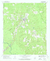
1970 Map of Rison
USGS Topo · Published 1972About this map
Rison serves as the central hub of this 1970 survey, where the St Louis Southwestern railroad cuts a diagonal line through the landscape of Cleveland County. The town site is surrounded by a dense network of local cemeteries and country churches, reflecting a deeply rooted rural community. To the east, the smaller settlement of Toledo sits near several Gravel Pits, while the southwestern corner of the map is defined by the winding course of the Saline River. The terrain is shaped by numerous tributaries including Harrison Creek, Varnell Creek, and Derrieusseaux Creek, which drain the timbered lands. Evidence of mid-century infrastructure is visible in the Radio Tower, Substation, and the local Country Club, marking the gradual modernization of this traditional Arkansas river basin region during the post-war era.
Find a feature on this map
30 named features on this map. Tap any name to fly to it.
Don’t see what you’re looking for? This feature index may not catch every label — zoom into the map to look around manually.
Map Details
Editions of this 1970 Rison Map
2 editions found
Other maps of this area

1953 · El Dorado
USGS Topo · 1:250,000

1955 · Little Rock
USGS Topo · 1:250,000

1956 · Little Rock
USGS Topo · 1:250,000

1957 · El Dorado
USGS Topo · 1:250,000

1958 · El Dorado
USGS Topo · 1:250,000

1960 · El Dorado
USGS Topo · 1:250,000

1960 · Little Rock
USGS Topo · 1:250,000

1962 · Faith
USGS Topo · 1:24,000

1962 · Kedron
USGS Topo · 1:24,000

1964 · Little Rock
USGS Topo · 1:250,000