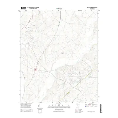
2014 Map of New Ellenton SW
USGS Topo · Published 2014About this map
The Savanna River site dominates this landscape along the border of Aiken Co and Barnwell Co, showing a highly controlled environment where natural drainages meet industrial infrastructure. The terrain is defined by a dense network of tributaries including Upper Three Runs, Fourmile Br, and Tinker Cr, which carve through the wooded South Carolina coastal plain. While large portions of the area are restricted, evidence of earlier local history remains in the form of the Ford Cem located near the intersection of Green Pond Rd and Doe Ct. Transportation routes like Whiskey Rd and Atomic Rd underscore the mid-century evolution of this region. The map provides an important record for researchers looking at the intersection of public land management and the preservation of small family landmarks within the expansive river site territory.
Find a feature on this map
17 named features on this map. Tap any name to fly to it.
Don’t see what you’re looking for? This feature index may not catch every label — zoom into the map to look around manually.
Map Details
Editions of this 2014 New Ellenton SW Map
This is the sole edition of this map. No revisions or reprints were ever made.
Other maps of this area

1920 · Ellenton
USGS Topo · 1:48,000

1920 · Greens Cut
USGS Topo · 1:62,500

1920 · Talatha
USGS Topo · 1:48,000

1921 · Augusta
USGS Topo · 1:62,500

1921 · Talatha
USGS Topo · 1:62,500

1921 · Ellenton
USGS Topo · 1:62,500

1943 · Greens Cut
USGS Topo · 1:62,500

1943 · Augusta East
USGS Topo · 1:125,000

1943 · Talatha
USGS Topo · 1:62,500

1943 · Augusta
USGS Topo · 1:62,500