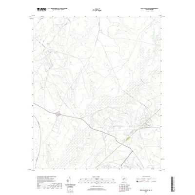
2020 Map of New Ellenton SW
USGS Topo · Published 2020About this map
Upper Three Runs dominates the hydrology of this South Carolina landscape, carving a wide, wetland-heavy valley through the terrain. The area is defined by its network of tributaries, including Tims Branch, Turner Branch, and Fourmile Br, which converge toward the southwest. This 2020 survey illustrates the sparse, industrial-adjacent character of the region near the Aiken and Barnwell county line.
Find a feature on this map
16 named features on this map. Tap any name to fly to it.
Don’t see what you’re looking for? This feature index may not catch every label — zoom into the map to look around manually.
Map Details
Editions of this 2020 New Ellenton SW Map
This is the sole edition of this map. No revisions or reprints were ever made.
Other maps of this area

1920 · Ellenton
USGS Topo · 1:48,000

1920 · Greens Cut
USGS Topo · 1:62,500

1920 · Talatha
USGS Topo · 1:48,000

1921 · Augusta
USGS Topo · 1:62,500

1921 · Talatha
USGS Topo · 1:62,500

1921 · Ellenton
USGS Topo · 1:62,500

1943 · Greens Cut
USGS Topo · 1:62,500

1943 · Augusta East
USGS Topo · 1:125,000

1943 · Talatha
USGS Topo · 1:62,500

1943 · Augusta
USGS Topo · 1:62,500