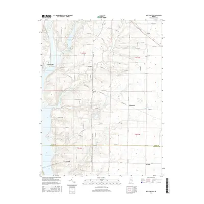
2016 Map of New Fairfield
USGS Topo · Published 2016About this map
Brookville Lake and Whitewater Lake define the western geography of this Union and Franklin County borderland. The terrain is a network of small creeks and runs, including Silver Creek, Hanna Cr, and Blue Lick, which have shaped the settlement patterns of rural hamlets like Dunlapsville and Roseburg. The map reveals a dense grid of township roads and family-named routes such as S Treaty Line Rd and S Pea Ridge Rd, which provide important context for researchers tracing the historical development of these agricultural communities.
Find a feature on this map
83 named features on this map. Tap any name to fly to it.
Don’t see what you’re looking for? This feature index may not catch every label — zoom into the map to look around manually.
Map Details
Editions of this 2016 New Fairfield Map
This is the sole edition of this map. No revisions or reprints were ever made.
Other maps of this area

1915 · College Corner
USGS Topo · 1:48,000

1915 · Harrison
USGS Topo · 1:48,000

1918 · College Corner
USGS Topo · 1:62,500

1948 · Fairfield
USGS Topo · 1:24,000

1953 · Cincinnati
USGS Topo · 1:250,000

1955 · Reily
USGS Topo · 1:24,000

1955 · Mount Carmel
USGS Topo · 1:24,000

1956 · Everton
USGS Topo · 1:24,000

1956 · Brownsville
USGS Topo · 1:24,000

1956 · Brookville
USGS Topo · 1:24,000