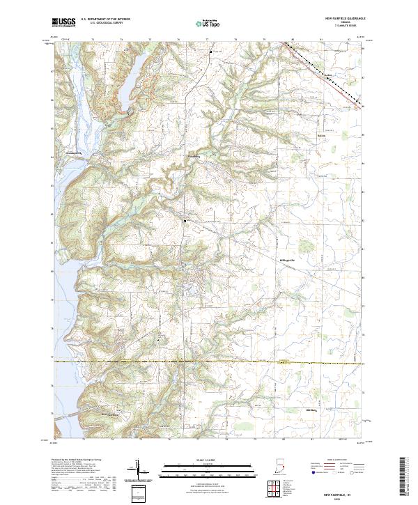
2022 Map of New Fairfield
USGS Topo · Published 2022About this map
Brookville Lake and the East Fork Whitewater River valley define this portion of the Indiana-Ohio borderlands. The settlement of New Fairfield sits at the southern edge of the quadrangle, where the terrain transitions toward the valley floor. To the north, the recreational and ecological corridor surrounding Whitewater State Park Rd is marked by numerous trails, including Bridle Trl and Trail 1-Trl, suggesting a landscape shaped by both conservation and active public use. Smaller rural hamlets like Lotus, Salem, and Billingsville are connected by a network of county roads that navigate the ridges and stream valleys formed by Hanna Cr and Dubois Cr. Genealogists may find value in the scattered burial grounds, such as Bath Springs Cem near the Union-Franklin County line and Calvary Cem further north, which provide a physical link to the area's agricultural past.
Find a feature on this map
97 named features on this map. Tap any name to fly to it.
Don’t see what you’re looking for? This feature index may not catch every label — zoom into the map to look around manually.
Map Details
Editions of this 2022 New Fairfield Map
This is the sole edition of this map. No revisions or reprints were ever made.
Other maps of this area

1915 · College Corner
USGS Topo · 1:48,000

1915 · Harrison
USGS Topo · 1:48,000

1918 · College Corner
USGS Topo · 1:62,500

1948 · Fairfield
USGS Topo · 1:24,000

1953 · Cincinnati
USGS Topo · 1:250,000

1955 · Reily
USGS Topo · 1:24,000

1955 · Mount Carmel
USGS Topo · 1:24,000

1956 · Everton
USGS Topo · 1:24,000

1956 · Brownsville
USGS Topo · 1:24,000

1956 · Brookville
USGS Topo · 1:24,000