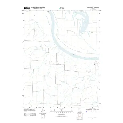
2012 Map of New Frankfort
USGS Topo · Published 2012About this map
The Missouri River carves a significant path through this portion of Saline County, defining the landscape with dramatic curves like Grand River Bend and Bushwhacker Bend. This 2012 survey illustrates the river's dynamic nature, showing the Cut-Off Lake and the managed infrastructure of Levee Unit Number L246 designed to control the seasonal shifts of the waterway. The small settlement of New Frankfort serves as a local anchor, situated near the intersection of several rural routes including Co Hwy 411 and Co Rd 108.
Find a feature on this map
33 named features on this map. Tap any name to fly to it.
Don’t see what you’re looking for? This feature index may not catch every label — zoom into the map to look around manually.
Map Details
Editions of this 2012 New Frankfort Map
This is the sole edition of this map. No revisions or reprints were ever made.
Other maps of this area

1890 · Glasgow
USGS Topo · 1:125,000

1890 · Marshall
USGS Topo · 1:125,000

1892 · Marshall
USGS Topo · 1:125,000

1901 · Marshall
USGS Topo · 1:125,000

1940 · Marshall
USGS Topo · 1:62,500

1944 · Marshall
USGS Topo · 1:62,500

1947 · Glasgow
USGS Topo · 1:62,500

1951 · Miami
USGS Topo · 1:24,000

1951 · Brunswick West
USGS Topo · 1:24,000

1951 · Brunswick East
USGS Topo · 1:24,000