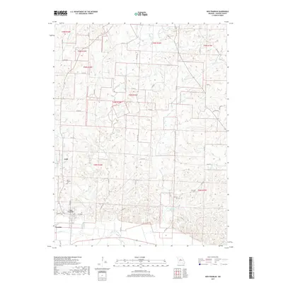
2017 Map of New Franklin
USGS Topo · Published 2017About this map
New Franklin and Franklin anchor the southern reaches of this Howard County landscape, situated near the winding course of Bonne Femme Creek. The region is defined by a dense network of tributaries including Salt Cr, Adams Fork, and Dry Cr, which carve through the terrain north of the Missouri River valley. Significant for genealogical research, the map identifies several local burial sites such as Mount Pleasant Cem near the settlement of Estill, as well as Drake Cem and Robinson Cem further east. The transition from the clustered streets of New Franklin, marked by W Broadway and E Broadway, to the outlying rural reaches illustrates a classic Midwestern pattern of small-town centers giving way to agricultural land and wooded creek bottoms like those surrounding Sulphur Cr.
Find a feature on this map
51 named features on this map. Tap any name to fly to it.
Don’t see what you’re looking for? This feature index may not catch every label — zoom into the map to look around manually.
Map Details
Editions of this 2017 New Franklin Map
This is the sole edition of this map. No revisions or reprints were ever made.
Other maps of this area

1888 · Boonville
USGS Topo · 1:125,000

1890 · Glasgow
USGS Topo · 1:125,000

1947 · Glasgow
USGS Topo · 1:62,500

1947 · Jefferson City
USGS Topo · 1:250,000

1952 · Rocheport
USGS Topo · 1:24,000

1952 · Boonville
USGS Topo · 1:24,000

1952 · New Franklin
USGS Topo · 1:24,000

1952 · Hilldale
USGS Topo · 1:24,000

1953 · Moberly
USGS Topo · 1:250,000

1953 · Fayette
USGS Topo · 1:24,000