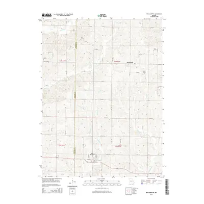
2014 Map of New Hampton
USGS Topo · Published 2014About this map
New Hampton and Martinsville serve as the primary population centers in this rural landscape spanning the Gentry and Harrison County line. The terrain is deeply defined by a dense network of watercourses, including Sampson Cr, White Oak Cr, and Panther Cr, which carve through the land and dictate the placement of local roads and farmsteads. Family and community history is preserved in several small burial grounds such as Grace Cemetery, Lone Star Cemetery, Kidwell Cemetery, and Magee Cemetery. The map reflects a classic midwestern agricultural grid, where state routes like State Highway FF and W State Highway J intersect with numerous numbered rural roads. Small drainage features like Weldon Br and Ames Br underscore the importance of local hydrology in this northern Missouri region.
Find a feature on this map
67 named features on this map. Tap any name to fly to it.
Don’t see what you’re looking for? This feature index may not catch every label — zoom into the map to look around manually.
Map Details
Editions of this 2014 New Hampton Map
This is the sole edition of this map. No revisions or reprints were ever made.
Other maps of this area

1925 · Pattonsburg
USGS Topo · 1:62,500

1925 · Darlington
USGS Topo · 1:62,500

1942 · Grant City
USGS Topo · 1:62,500

1943 · Grant City
USGS Topo · 1:62,500

1944 · Pattonsburg
USGS Topo · 1:62,500

1946 · Pattonsburg
USGS Topo · 1:48,000

1948 · Bethany
USGS Topo · 1:62,500

1948 · Pattonsburg
USGS Topo · 1:62,500

1950 · Darlington
USGS Topo · 1:62,500

1955 · Nebraska City
USGS Topo · 1:250,000