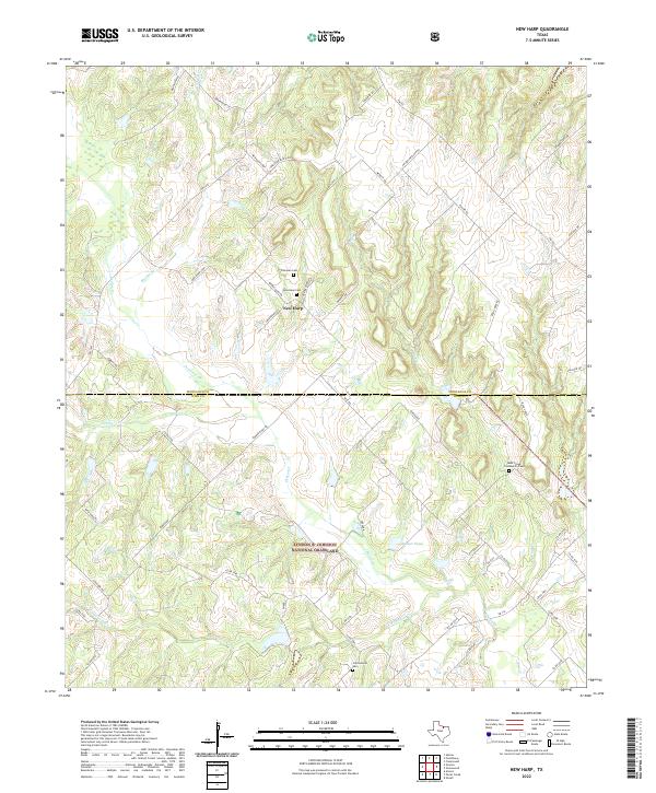
2022 Map of New Harp
USGS Topo · Published 2022About this map
The tiny settlement of New Harp serves as the focal point for this rural landscape where Montague County and Wise County meet. The terrain is defined by the headwaters and branches of several significant local waterways, including Denton Creek, Panther Creek, and Rush Creek. This is a landscape of established family farms and cemetery sites, such as Freeman Cemetery and New Harp Cemetery, which suggest a long-standing community tied to the land. Large portions of the southern quadrangle are preserved within the Lyndon B. Johnson National Grassland, where natural drainage patterns and the artificial Rucker Pond dominate the geography. The road network, including New Harp Loop and Valentine Bluff Road, follows the contours of the numerous creek branches like Braden Branch, illustrating how the drainage of the Trinity River basin has dictated local movement and development for generations.
Find a feature on this map
56 named features on this map. Tap any name to fly to it.
Don’t see what you’re looking for? This feature index may not catch every label — zoom into the map to look around manually.
Map Details
Editions of this 2022 New Harp Map
This is the sole edition of this map. No revisions or reprints were ever made.
Other maps of this area

1902 · Gainesville
USGS Topo · 1:125,000

1905 · Montague
USGS Topo · 1:125,000

1943 · Gainesville
USGS Topo · 1:125,000

1954 · Sherman
USGS Topo · 1:250,000

1958 · Sherman
USGS Topo · 1:250,000

1961 · Pecan Creek
USGS Topo · 1:24,000

1961 · Salona
USGS Topo · 1:24,000

1961 · Alvord
USGS Topo · 1:24,000

1961 · Freemound
USGS Topo · 1:24,000

1961 · New Harp
USGS Topo · 1:24,000