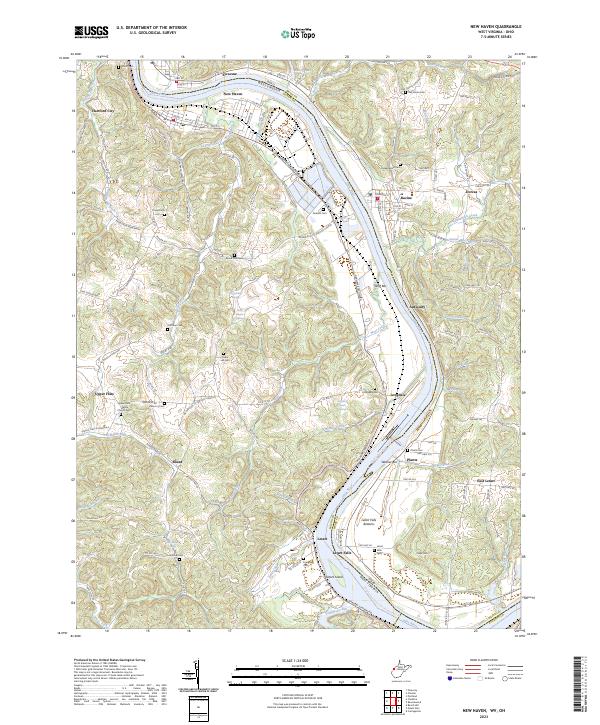
2023 Map of New Haven
USGS Topo · Published 2023About this map
Ohio River navigation and riparian settlements define this stretch of the West Virginia and Ohio border. The river's winding path is punctuated by features like Wolf Bar, Weaver Bar, and the large Letart Island near the southern bend. Communities such as New Haven, Hartford City, and Syracuse are established along the northern bank, while smaller hamlets like Antiquity and Letart Falls occupy the opposite shore. The map details a landscape of narrow runs and creeks, including Broad Run and West Creek, which have shaped the local topography.
Find a feature on this map
123 named features on this map. Tap any name to fly to it.
Don’t see what you’re looking for? This feature index may not catch every label — zoom into the map to look around manually.
Map Details
Editions of this 2023 New Haven Map
This is the sole edition of this map. No revisions or reprints were ever made.
Other maps of this area

1907 · Pomeroy
USGS Topo · 1:62,500

1907 · Keno
USGS Topo · 1:62,500

1908 · Ravenswood
USGS Topo · 1:62,500

1908 · Point Pleasant
USGS Topo · 1:62,500

1926 · Ravenswood
USGS Topo · 1:62,500

1926 · Point Pleasant
USGS Topo · 1:62,500

1928 · Ravenswood
USGS Topo · 1:62,500

1929 · Point Pleasant
USGS Topo · 1:62,500

1947 · Columbus
USGS Topo · 1:250,000

1949 · Clarksburg
USGS Topo · 1:250,000