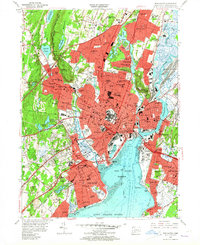
1954 Map of New Haven
USGS Topo · Published 1964About this map
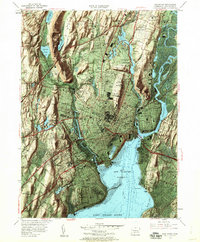
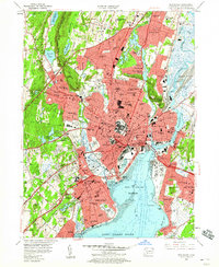
New Haven and its surrounding boroughs are shown at a peak of mid-century development, where the industrial legacy of the Quinnipiac River and Mill River meets modern infrastructure like the Connecticut Turnpike. The map captures the dense academic and civic core, featuring Yale University, City Hall, and the Yale Bowl. Surrounding neighborhoods such as Westville, Fair Haven, and Whitneyville display the suburban expansion of the 1950s, supported by a vast network of primary and secondary schools. The southern edge of the sheet transitions to the maritime landscape of New Haven Harbor and Long Island Sound, where the New Haven Municipal Airport and landmarks like the Lighthouse anchor the coast. Local heritage is preserved in numerous locations, from the St Lawrence Cemetery and St Andrews Ch to geologic features like Judges Cave and Snake Rock, illustrating the varied terrain of New Haven Co..
Find a feature on this map
98 named features on this map. Tap any name to fly to it.
Don’t see what you’re looking for? This feature index may not catch every label — zoom into the map to look around manually.
Map Details
Editions of this 1954 New Haven Map
6 editions found
Other maps of this area

1889 · Derby
USGS Topo · 1:62,500

1891 · Bridgeport
USGS Topo · 1:62,500

1891 · Derby
USGS Topo · 1:62,500

1892 · New Haven
USGS Topo · 1:62,500

1893 · Bridgeport
USGS Topo · 1:62,500

1893 · Derby
USGS Topo · 1:62,500

1920 · Bridgeport
USGS Topo · 1:62,500

1921 · New Haven
USGS Topo · 1:62,500

1943 · New Haven
USGS Topo · 1:31,680

1943 · Naugatuck
USGS Topo · 1:31,680