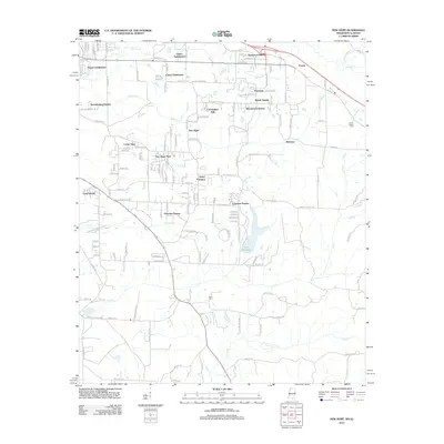
2012 Map of New Hope
USGS Topo · Published 2012About this map
Lake Lowndes and its surrounding woodlands define the central landscape of this Lowndes County area just east of Columbus. The 2012 survey illustrates a transition from the structured residential clusters of New Hope and McCrary to the broader rural terrain along the Alabama state line. The map detail reflects significant suburban development, characterized by numerous named residential enclaves like Lakeover Estates, Cedar View, and Sweedenburg Estates.
Find a feature on this map
154 named features on this map. Tap any name to fly to it.
Don’t see what you’re looking for? This feature index may not catch every label — zoom into the map to look around manually.
Map Details
Editions of this 2012 New Hope Map
This is the sole edition of this map. No revisions or reprints were ever made.
Other maps of this area

1953 · West Point
USGS Topo · 1:250,000

1958 · West Point
USGS Topo · 1:250,000
1960 · Caledonia
USGS Topo · 1:62,500
1960 · Columbus
USGS Topo · 1:62,500

1963 · West Point
USGS Topo · 1:250,000
1966 · Ethelsville
USGS Topo · 1:24,000
1966 · Reform SW
USGS Topo · 1:24,000
1967 · Fernbank
USGS Topo · 1:24,000
1982 · West Point
USGS Topo · 1:100,000
1984 · West Point
USGS Topo · 1:250,000