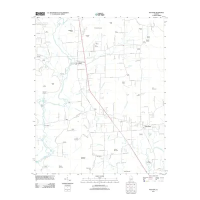
2011 Map of New Hope
USGS Topo · Published 2011About this map
The Flint River and Paint Rock River define the hydrological character of this Madison County landscape, where small communities are interconnected by the corridor of Old Highway 431. The map reveals a high density of family and community burial grounds, such as Moon Cemetery, Byrd Cemetery, and Stewart Cemetery, which speak to the long-standing settlement patterns of the region. Significant terrain features like Christian Mountain and Haymer Mountain rise above the river valleys, creating distinct gaps such as Hines Gap and Macedonia Gap. This 2011 survey captures the area as residential expansion, evidenced by Hampton Cove, meets established agrarian pockets like Elon and Oak Grove. The presence of the Owens Cross Roads Post Office and Buggs Chapel further highlights the local institutional hubs that have served these rural and suburbanizing neighborhoods over decades.
Find a feature on this map
137 named features on this map. Tap any name to fly to it.
Don’t see what you’re looking for? This feature index may not catch every label — zoom into the map to look around manually.
Map Details
Editions of this 2011 New Hope Map
This is the sole edition of this map. No revisions or reprints were ever made.
Other maps of this area

1885 · Gadsden
USGS Topo · 1:125,000

1888 · Cullman
USGS Topo · 1:125,000

1888 · Gadsden
USGS Topo · 1:125,000

1888 · Scottsboro
USGS Topo · 1:125,000

1888 · Huntsville
USGS Topo · 1:125,000

1892 · Cullman
USGS Topo · 1:125,000

1892 · Huntsville
USGS Topo · 1:125,000

1892 · Scottsboro
USGS Topo · 1:125,000

1892 · Gadsden
USGS Topo · 1:125,000

1895 · Gadsden
USGS Topo · 1:125,000