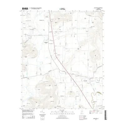
2014 Map of New Hope
USGS Topo · Published 2014About this map
New Hope and Owens Cross Roads serve as the primary anchors for this Madison County landscape, where the Flint River winds southward through a corridor defined by prominent heights like Christian Mtn and Lemley Mtn. The 2014 terrain is characterized by a high density of family-named cemeteries and landmarks, such as Neal Chapel Cem, Bush Cem, and Vann Cem, offering significant value for genealogical research in Northern Alabama. The map reveals the intricate water network feeding the river valley, including The Bayou, Yellow Bank Cr, and numerous springs like Baker Spring and New Hope Spring. Movement through the area is defined by the Us-431 corridor and Old 431 Hwy, connecting established settlements with the distinctive topography of Glover Cove and Big Cove. This recent survey preserves the modern footprint of these communities just north of the Madison and Marshall county line.
Find a feature on this map
136 named features on this map. Tap any name to fly to it.
Don’t see what you’re looking for? This feature index may not catch every label — zoom into the map to look around manually.
Map Details
Editions of this 2014 New Hope Map
This is the sole edition of this map. No revisions or reprints were ever made.
Other maps of this area

1885 · Gadsden
USGS Topo · 1:125,000

1888 · Cullman
USGS Topo · 1:125,000

1888 · Gadsden
USGS Topo · 1:125,000

1888 · Scottsboro
USGS Topo · 1:125,000

1888 · Huntsville
USGS Topo · 1:125,000

1892 · Cullman
USGS Topo · 1:125,000

1892 · Huntsville
USGS Topo · 1:125,000

1892 · Scottsboro
USGS Topo · 1:125,000

1892 · Gadsden
USGS Topo · 1:125,000

1895 · Gadsden
USGS Topo · 1:125,000