
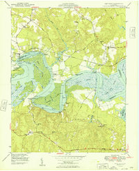
1949 Map of New Kent
USGS Topo · Published 1949About this map
The Pamunkey Indian Reservation borders the winding southern bank of the river in this late 1940s survey of the Virginia Tidewater. The landscape is defined by the sweeping bends of the Pamunkey River and its intricate network of marshes, including Cousaic Marsh, Lilly Point Marsh, and Sweet Hall Marsh. Settlement patterns are tied closely to the water, with numerous landings such as Riverview Landing, Brickhouse Landing, and Cumberland Landing serving as vital points of access.
Find a feature on this map
61 named features on this map. Tap any name to fly to it.
Don’t see what you’re looking for? This feature index may not catch every label — zoom into the map to look around manually.
Map Details
Editions of this 1949 New Kent Map
2 editions found
Other maps of this area

1917 · Toano
USGS Topo · 1:62,500

1918 · Charles City
USGS Topo · 1:62,500

1918 · Toano
USGS Topo · 1:62,500

1919 · New Kent
USGS Topo · 1:62,500

1920 · King William
USGS Topo · 1:62,500

1943 · Richmond
USGS Topo · 1:250,000
1949 · Truhart
USGS Topo · 1:24,000
1949 · King William
USGS Topo · 1:24,000
1949 · King And Queen
USGS Topo · 1:24,000

1949 · Tunstall
USGS Topo · 1:24,000