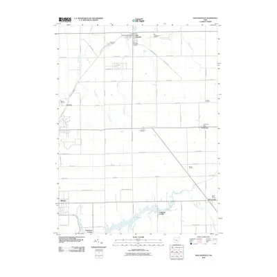
2010 Map of New Knoxville
USGS Topo · Published 2010About this map
New Knoxville sits at the northern edge of this West Central Ohio landscape, where the agricultural grid is interrupted by the headwaters of Loramie Creek and the sprawling waters of Lake Loramie. The 2010 survey highlights a region deeply tied to its early German heritage, evidenced by a high concentration of rural cemeteries such as Pilger Ruhe Cemetery, German Cemetery, and Sacred Heart Cemetery. Local transportation and community life center on historic village clusters like Minster and McCartyville, while Neil Armstrong Airport north of town serves as a modern landmark. The terrain is marked by an extensive drainage network including White Feather Ditch and Center Branch, which support the productive farmland surrounding the lakeside landings of Hegemanns Landing and Lehmkuhl Landing.
Find a feature on this map
54 named features on this map. Tap any name to fly to it.
Don’t see what you’re looking for? This feature index may not catch every label — zoom into the map to look around manually.
Map Details
Editions of this 2010 New Knoxville Map
This is the sole edition of this map. No revisions or reprints were ever made.
Other maps of this area

1906 · Lima
USGS Topo · 1:62,500

1909 · Loramie
USGS Topo · 1:62,500

1911 · Loramie
USGS Topo · 1:62,500

1911 · Spencerville
USGS Topo · 1:62,500

1913 · Sidney
USGS Topo · 1:62,500

1944 · Sidney
USGS Topo · 1:62,500

1944 · Loramie
USGS Topo · 1:62,500

1944 · Spencerville
USGS Topo · 1:62,500

1953 · Muncie
USGS Topo · 1:250,000

1956 · Muncie
USGS Topo · 1:250,000