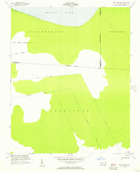
1954 Map of New Lake NW
USGS Topo · Published 1957About this map
Phelps Lake dominates the northern reaches of this coastal plain landscape, where the borders of Washington, Tyrrell, and Hyde counties converge. The terrain is defined by low-lying wetlands and extensive drainage networks, including the prominent Huntinghouse Canal and Lake Canal. These engineered waterways, alongside smaller streams like White Cypress Tributary and Third Tributary, illustrate the mid-century efforts to manage the hydrology of the Scuppernong and Currituck regions.
Find a feature on this map
11 named features on this map. Tap any name to fly to it.
Don’t see what you’re looking for? This feature index may not catch every label — zoom into the map to look around manually.
Map Details
Editions of this 1954 New Lake NW Map
3 editions found
Other maps of this area

1914 · Belhaven
USGS Topo · 1:48,000

1916 · Belhaven
USGS Topo · 1:62,500

1943 · Columbia
USGS Topo · 1:125,000

1943 · Plymouth
USGS Topo · 1:125,000

1951 · Belhaven
USGS Topo · 1:24,000

1951 · Ponzer
USGS Topo · 1:24,000

1951 · New Lake SE
USGS Topo · 1:24,000

1953 · Rocky Mount
USGS Topo · 1:250,000

1954 · Rocky Mount
USGS Topo · 1:250,000

1954 · Roper South
USGS Topo · 1:24,000