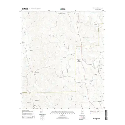
2014 Map of New Lexington
USGS Topo · Published 2014About this map
New Lexington anchors this rural landscape at the border of Fayette and Tuscaloosa Counties, where the drainage basins of the North River and Binion Cr meet. The area is defined by a series of small agricultural and residential nodes, including New Hope and Concord, connected by a network of county roads like CR-12 and Us-43. The map is particularly rich in family-named sites, indicating a long-standing community tied to the land. Numerous burial grounds such as Willingham Cem, Vick and Kelley Cem, and Patterson Cem are scattered across the terrain, often located near small water bodies like Barnett Lake or the Poe Lakes. The presence of several churches, including El Bethel Cem and Macedonia Cem, further highlights the cultural geography of this section of the Deep South in the early 21st century.
Find a feature on this map
82 named features on this map. Tap any name to fly to it.
Don’t see what you’re looking for? This feature index may not catch every label — zoom into the map to look around manually.
Map Details
Editions of this 2014 New Lexington Map
This is the sole edition of this map. No revisions or reprints were ever made.
Other maps of this area

1926 · Samantha
USGS Topo · 1:48,000

1928 · Samantha
USGS Topo · 1:62,500

1953 · Birmingham
USGS Topo · 1:250,000

1956 · Birmingham
USGS Topo · 1:250,000

1957 · Birmingham
USGS Topo · 1:250,000

1967 · Brownville
USGS Topo · 1:24,000

1967 · Bankston
USGS Topo · 1:24,000

1967 · Newtonville
USGS Topo · 1:24,000
1967 · Berry
USGS Topo · 1:24,000

1967 · Fayette
USGS Topo · 1:24,000