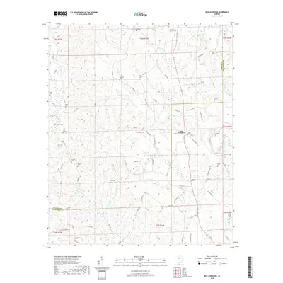
2018 Map of New Lexington
USGS Topo · Published 2018About this map
New Lexington stands at the heart of this landscape, marking a rural hub where the North River and its numerous tributaries define the terrain of both Tuscaloosa and Fayette counties. The region is densely populated with family and community burial grounds, illustrating a deep genealogical footprint throughout the countryside. Locations such as the Vick and Kelley Cem in the north and the Camp Ground Cem in the southeast suggest long-standing rural congregations and family landholdings. Small water bodies like Poe Lakes and the winding course of Binion Cr indicate a topography shaped by small-scale farming and local drainage patterns. The road network, including Fayette Rd and New Hope Rd, connects these disparate homesteads and cemeteries, reflecting a community layout that has remained centered on traditional crossroads and watercourses.
Find a feature on this map
90 named features on this map. Tap any name to fly to it.
Don’t see what you’re looking for? This feature index may not catch every label — zoom into the map to look around manually.
Map Details
Editions of this 2018 New Lexington Map
This is the sole edition of this map. No revisions or reprints were ever made.
Other maps of this area

1926 · Samantha
USGS Topo · 1:48,000

1928 · Samantha
USGS Topo · 1:62,500

1953 · Birmingham
USGS Topo · 1:250,000

1956 · Birmingham
USGS Topo · 1:250,000

1957 · Birmingham
USGS Topo · 1:250,000

1967 · Brownville
USGS Topo · 1:24,000

1967 · Bankston
USGS Topo · 1:24,000

1967 · Newtonville
USGS Topo · 1:24,000
1967 · Berry
USGS Topo · 1:24,000

1967 · Fayette
USGS Topo · 1:24,000