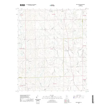
2020 Map of New Lexington
USGS Topo · Published 2020About this map
New Lexington serves as the central focal point for this rural landscape where the North River and its numerous tributaries, including Freeman Cr and Binion Cr, define the topography across the Fayette and Tuscaloosa county line. The map is particularly dense with small family and community burial grounds, revealing a deep-rooted lineage of local settlement. From the Vick and Kelley Cem in the north to the Macedonia Cem in the south, these sites are often situated near landmarks such as Barnett Lake or along rural corridors like Co RD 89 and Co RD 55. This modern topographic survey provides a clear view of the dispersed agricultural and residential patterns that persist in this part of Alabama, where the network of named branches and creeks like Wolf Cr and Boone Cr have long dictated the placement of homesteads and roads.
Find a feature on this map
94 named features on this map. Tap any name to fly to it.
Don’t see what you’re looking for? This feature index may not catch every label — zoom into the map to look around manually.
Map Details
Editions of this 2020 New Lexington Map
This is the sole edition of this map. No revisions or reprints were ever made.
Other maps of this area

1926 · Samantha
USGS Topo · 1:48,000

1928 · Samantha
USGS Topo · 1:62,500

1953 · Birmingham
USGS Topo · 1:250,000

1956 · Birmingham
USGS Topo · 1:250,000

1957 · Birmingham
USGS Topo · 1:250,000

1967 · Brownville
USGS Topo · 1:24,000

1967 · Bankston
USGS Topo · 1:24,000

1967 · Newtonville
USGS Topo · 1:24,000
1967 · Berry
USGS Topo · 1:24,000

1967 · Fayette
USGS Topo · 1:24,000