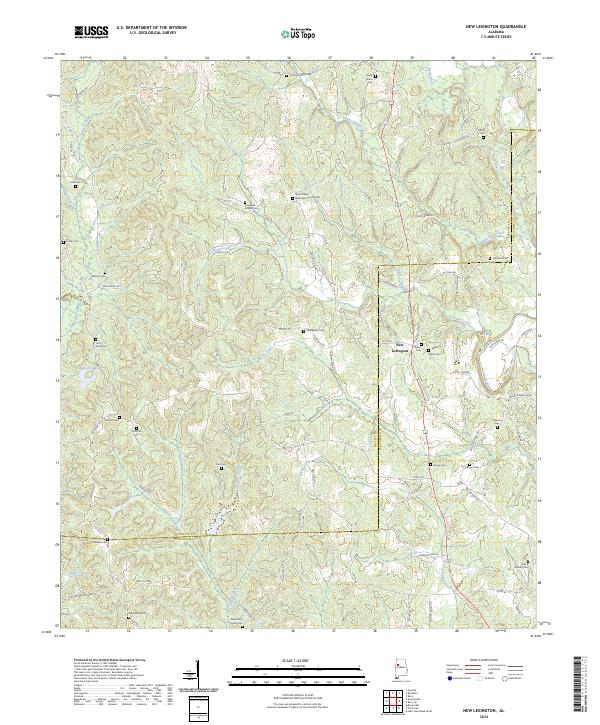
2024 Map of New Lexington
USGS Topo · Published 2024About this map
The borderlands of Fayette and Tuscaloosa Counties are defined by a deeply dissected landscape of creeks and small family cemeteries. New Lexington serves as a central point in a territory where the North River and its tributaries, including Boone Creek and Binion Creek, carve through the terrain. The map is a significant resource for genealogists, documenting numerous small burial grounds such as Hopewell Rosehill Cem, Unity Grove Cem, and Macedonia Cem. Local transportation is anchored by a dense network of named rural routes like Jones Mill Rd and Roxie Ridge Rd. The presence of the New Chapel Methodist Church and its associated cemetery highlights the importance of traditional community centers. Smaller water bodies like Poe Lakes and Barnett Lake offer evidence of local land use and hydrology within this corner of Alabama.
Find a feature on this map
95 named features on this map. Tap any name to fly to it.
Don’t see what you’re looking for? This feature index may not catch every label — zoom into the map to look around manually.
Map Details
Editions of this 2024 New Lexington Map
This is the sole edition of this map. No revisions or reprints were ever made.
Other maps of this area

1926 · Samantha
USGS Topo · 1:48,000

1928 · Samantha
USGS Topo · 1:62,500

1953 · Birmingham
USGS Topo · 1:250,000

1956 · Birmingham
USGS Topo · 1:250,000

1957 · Birmingham
USGS Topo · 1:250,000

1967 · Brownville
USGS Topo · 1:24,000

1967 · Bankston
USGS Topo · 1:24,000

1967 · Newtonville
USGS Topo · 1:24,000
1967 · Berry
USGS Topo · 1:24,000

1967 · Fayette
USGS Topo · 1:24,000