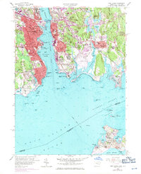
2024 Map of New London
USGS Topo · Published 2024About this map
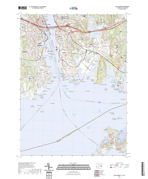
The Thames River serves as the central artery for this maritime landscape, dividing the historic city of New London from Groton and its naval heritage. On the western bank, the United States Coast Guard Academy and Mitchell College anchor the waterfront, while the New London County Courthouse and Ancient Cem speak to centuries of civic and social development. Across the water, the heights of Fort Griswold Hill and Fort Trumbull provide a strategic view of the harbor entrance, where the Cross Sound Ferry and other regional lines connect the mainland to Fishers Island and beyond. The eastern shore is densely punctuated with significant family burial grounds, including the Avery-Morgan Burial Ground Cem and the Colonel Ledyard Cem, while the industrial and residential corridors of Poquonock Bridge and Noank extend toward the rocky coastline of the Fishers Island Sound.
Find a feature on this map
139 named features on this map. Tap any name to fly to it.
Don’t see what you’re looking for? This feature index may not catch every label — zoom into the map to look around manually.
Map Details
Editions of this 2024 New London Map
This is the sole edition of this map. No revisions or reprints were ever made.
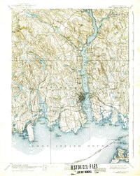
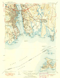
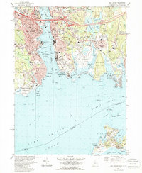
Historical Maps of Poquonock Bridge Through Time
7 maps found